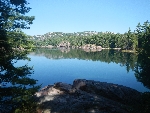
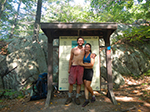
La Cloche Silhouette Trail - Killarney Ontario |
|
|---|---|
| A 78km Looping Trail. | |
| Access | The trail head of the La Cloche Silhouette Trail is located at the main park camp ground at George Lake. |
| Length | 78km - loop |
| Time | 7 - 10 days |
| Difficulty | Portions of the trail are considered difficult due to numerous steep and rocky sections. |
| Reserve | Due to the limited number of sites, it is recommended to book early. This can be done using Ontario Parks Central Reservation Number, 1-888-ONT-PARK or 1-888-668-7275. |
Maps: Updated 2024 Killarney Park Maps, complete with location of all interior sites, contour lines and tips for backcountry travel can be purchased at Killarney Outfitters or from the Friends of Killarney Park at (705) 287-2800 or on-line at www.friendsofkillarneypark.ca
The origonal JEFF'S MAP (large file) Down load/or save here: http://killarneyoutfitters.com/LSTrail/Jeffs_Map.jpg
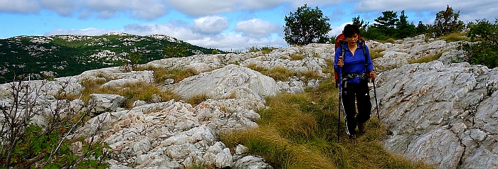
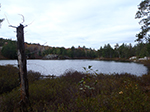
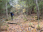
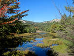
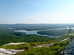
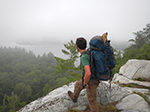
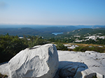
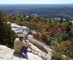
" The main trail at Killarney Provincial Park is a 78 km loop known as the La Cloche Silhouette Trail. In 2004, 3 kms were added around H8, to bypass a bridge. You can travel in either direction around the loop but most backpackers travel in the clockwise direction, as in this photo hike. I believe this to be the best choice for several reasons. From what I have experienced on the screed and talus covered slopes on the north ridges, I would not want to do certain slopes in the counter clockwise direction because of safety considerations". ....Tom Simon
La Cloche Silhouette Trail discription guide
LA CLOCHE SILHOUETTE TRAIL, Killarney Provincial Park
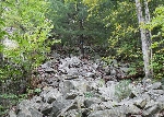
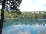
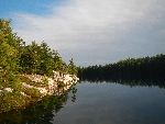
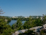
This challenging yet rewarding trail covers a total distance of 78 kilometers; passing over ridges, through valley bottoms and alongside picturesque crystal clear lakes. It is also Killarney Provincial Park’s only multi-day backpacking route.
The trail itself is dedicated to the memory of The Group of Seven artist Franklin Carmichael (1890-1945) and is named for his painting "La Cloche Silhouette".
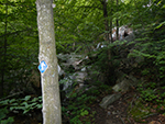
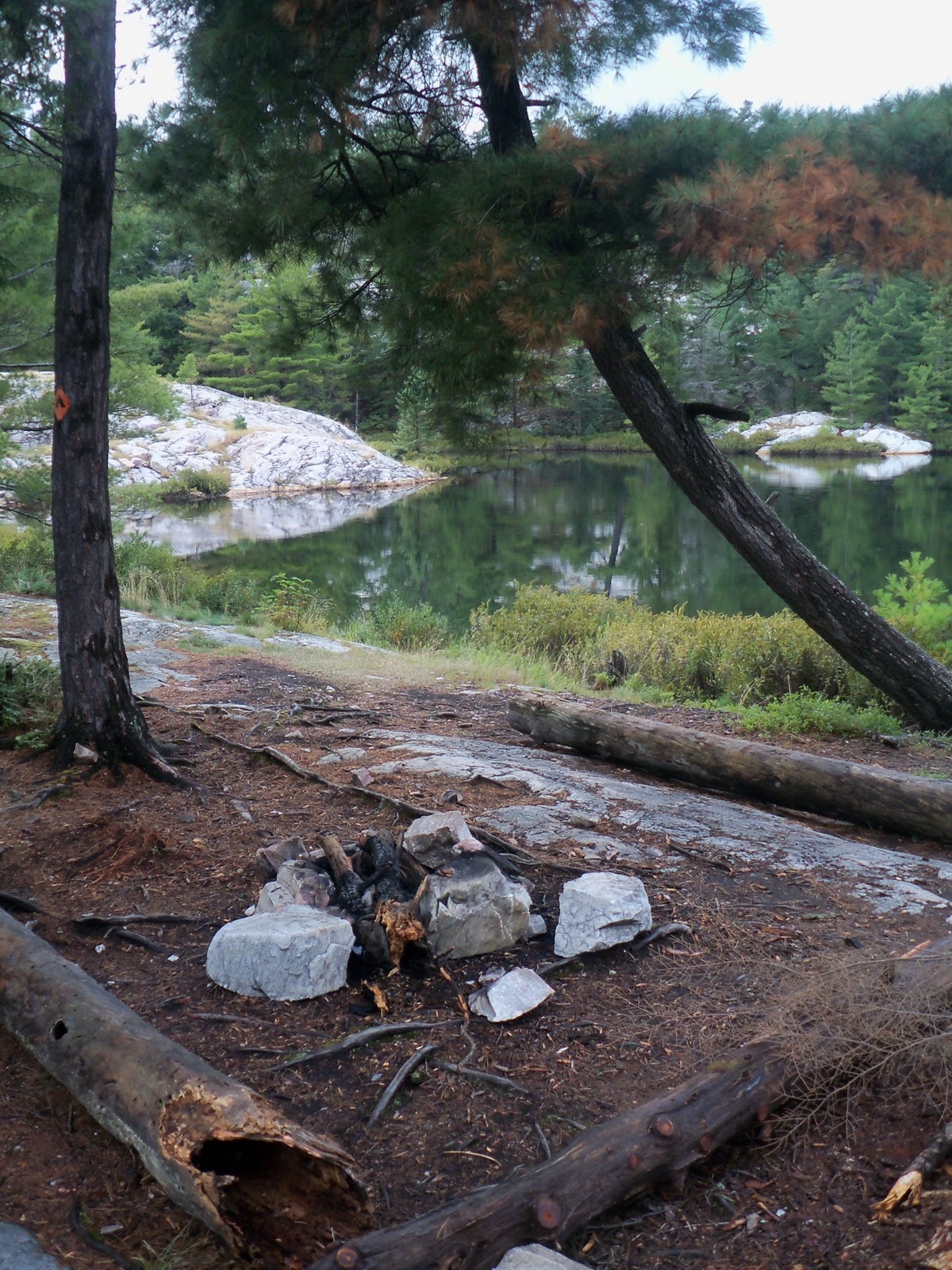
The La Cloche Silhouette trail is navigated by following the blue markers. The trail intersects in many places with day hikes signed in red markers, and campsites in yellow. Open areas without trees may also be marked on the ground in burgundy colored paint, or even large piles of rock. If no markers are to be seen, retrace your steps until one presents itself. There are many game trails and old logging roads along the way as well, watch for the markers!
Due to its length and rugged nature, the trail requires a good level of physical conditioning on part of the hiker, and should be carefully planned. The backpacker should plan on a 7 to 10 day outing, it is not suggested to attempt the hike in less than 5 days due to its difficulty.
To estimate hiking times we use an average of 2-3km/hour (this will vary depending on the section of the La Cloche being completed).
Please keep in mind that there is a specific site reserved for each night and that camping off trail or disregarding the planned route is highly discouraged by Killarney Provincial Park. If not on specified site, should assistance be required, your location will not be in accordance to the trip plan making it difficult to track the exact coordinates.
Park in the parking lot during the trip, some hikers prefer to park their vehicle at the end of trail and walk to the start point (make sure to put a parking permit in the vehicle). Doing this will alleviate the extra effort at the end of the hike.
*Suggestion to hike the trail clockwise which makes for less areas where steep incline has to be tackled with a heavy pack. If you prefer to hike inclines with a heavy pack and declines with a lighter pack counter clockwise is suggested.
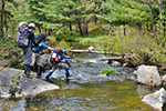
*Trail can be very muddy and slippery during heavy rain fall or a day or two after. Sections of the trail cross over creek beds that may be quite swelled during rain, and pose difficulty to pass.
*Expect to get your feet wet! Even during drier times of the season the trail still has areas that pass over beaver dams, creeks and marshy areas. Two pairs of socks is a must. (Wigwam Merino wool socks help keep your feet dry, blister free, and stink-less. (You’re new BFF with benefits)
*Hiking poles are suggested due to steep, rocky terrain
*Pack rain gear even if the weather is calling for good conditions
*Bring along a map, compass, and flashlight even if you think you can do without
GEORGE LAKE CAMPGROUND TO LUMSDEN LAKE
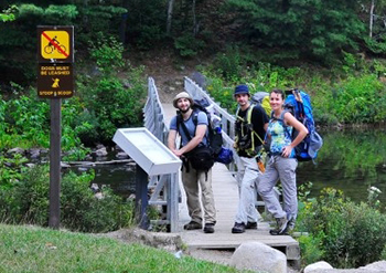
The journey begins! Start the trail at the western La Cloche trail head at George Lake. The trail starts at a set of stairs, which lead to a wooden bridge passing over George Lake.
From the western end of George Lake, the trail winds its way through stands of mixed deciduous and coniferous trees. This section of the trail is quite easy with no extreme inclines or declines. There are a few creeks to pass over along this route, when water levels are high this may pose difficulty.
If hiking without trekking poles, grab a large stick to help with balance! After passing over each creek keep a map at hand to ensure the correct direction of the trail has been chosen.
LUMSDEN LAKE ‚Äď H1, H2
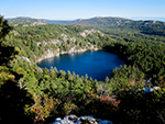
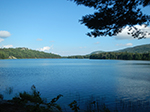
This is a lovely quartzite rimmed lake, and the first camping available for those doing the La Cloche Silhouette trail in the more common clockwise direction. The ridges around Lumsden have some beautiful views of the lake, surrounding hills, and Georgian Bay.
This is rugged terrain ‚Äď circumnavigating the lake is timely, pay attention to daylight. Notice the white quartzite rock. You have now crossed into a geological zone, dating back 2.3 billion years.
The creek draining Lumsden drops very steeply over a long series of cascades, some of them sizeable. Most of the time there isn’t much flow, but still an interesting place to check out. In high water they are quite impressive. There is no trail here, be equipped with a map and compass if trying to find them.
At times of low flow it may be tempting to swim around them. Please stay out of the creek, as the watershed upstream has many beaver dams which break every now and again. Such an event could cause the water to rise quickly.
There are two great campsites on the lake. H1 has many flat quartzite rocks to tan or jump in for a swim!
LUMSDEN LAKE TO ACID LAKE
From Lumsden Lake to Acid Lake, the trail passes over sections of corduroy road, remnants of bygone logging days.
Watch your footing as you approach the south western side of Acid Lake as there is a crossing that requires a lot of attention. This area is a mess of jumbled logs that require you to cross over. Once again if not hiking with trekking poles, grab a large stick to help with balance.
ACID LAKE ‚Äď H3, H4
Acid Lake is the second lake along the Silhouette trail, and it is just as beautiful as Lumsden. This is an excellent swimming area with colorful stone shorelines and a tiny island to swim to! H4 is on the main lake, while H3 is on a smaller pond just downstream of Acid.
Gulch Hill is a peak looming over Acid Lake, and the view looking north at the top is stunning. If attempting this, be equipped with a map, compass and a buddy. It is a rugged steep bushwhack to the top from campsite H4.
ACID LAKE TO CAVE LAKE
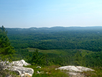
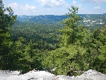
A little ways northwest of Acid Lake is a nice viewpoint beside the trail. When the trail begins to descend, there is a bedrock outcrop just to the west of the trail. (Left if heading towards Cave Lake). There is a crude trampled path out. This gives a lovely view overlooking the valley.
CAVE LAKE ‚Äď H5, H6
Cave Lake is named after the small cave in a rocky outcrop on the lake. Unlike the two lakes before it, this one is in the lowlands and isn’t a dead lake; that means Cave Lake has an ample stock of fish!
This lake has two campsites and is surrounded by heavily forested shoreline making it a great place to see wildlife…if quiet!
CAVE LAKE TO TOPAZ LAKE
Just past Cave Lake is a marshy area that can be quite wet after rainfall, watch footing!
Located at the valley bottom is meandering Artist Creek. Artist Creek is particularly pretty during July and August when wild flowers such as Pickerel Weed and other aquatic plants choke its waters. Follow the creek west and it will lead into the eastern end of Baie Fine known as ‚ÄúThe Pool‚ÄĚ.
Keep a map at hand in this location as the Silhouette trail joins with The Pig portage and a trail leading to Artist Lake.
It is worth the short detour to Baie Fine and view this picturesque spot. Owing to its spectacular scenery and remote location, the pool has long been a favorite of American yachtsmen.
The crossing at Artist Creek will most likely get your feet wet, if not hiking with a hiking poles consider grabbing a stick for balance.
The next section of the La Cloche Silhouette Trail was used as an old logging road and has been nicknamed ‚ÄúThe Pig‚ÄĚ portage; keep your map out to confirm the correct arm of the trail as it intersects with several other portages.
Approximately 230m up ‚ÄúThe Pig‚ÄĚ, Topaz Lake can be found on the west side of the trail.
Both Baie Fine and Topaz Lake can get very busy in the height of the summer season as it is a favorite spot for yachter, paddlers and hikers alike!
TOPAZ LAKE ‚Äď H7
Topaz Lake can be found along the Baie Fine section of the La Cloche Silhouette trail, nearly half way along ‚ÄúThe Pig‚ÄĚ portage into Threenarrows Lake. Topaz is an ultra-clear lake with white quartzite diving cliffs that go up at regular intervals giving it a crater-like look. This lake was the site of Arthur Lismer's (Group of Seven) work 'Bright Lands'.
The peak looking over Topaz has a stellar view up top. It is also a very steep and exposed climb. Only attempt this if equipped, fit, and if conditions are dry. Bring along a buddy to ensure safety.
TOPAZ LAKE TO THREENARROWS LAKE
When leaving Topaz Lake head back to the main trail along The Pig, take a left. Follow the trail up and over Blue Ridge. Watch carefully at this point as the La Cloche trail can be easily missed on the left. Keep a map at hand if you are unsure of the direction. The trail does not bring you down to Threenarrows at this point. If you reach the lake turn around and locate the trail on the right hand side.
Once Kirk Creek is reached it may be tempting to try and cross here to avoid taking the trail all the way around. This course is inadvisable as the trail is difficult to rejoin upon reaching the other side!
Be pleased to know this section of the trail is relatively flat leading to Bodina Lake! Watch as the kilometers pass by without difficulty as you hike along the shorelines of Threenarrows and through the forested areas of the old logging days.
THREENARROWS LAKE ‚Äď H8, H16, H17, H18, H19, H20 (located on a pond off Threenarrows), H21
Vast Threenarrows Lake is the product of bygone logging activity in the Killarney area. Originally named Long Lake, the body of water we see today was created in 1900 when a wooden dam was constructed across Kirk Creek (on the western end of the lake). This caused the water levels in three pre-existing lakes to rise by five meters and overflow into each other. This massive new lake allowed logging companies to float their logs a great distance, and enabled them to expand further east than was previously possible. In exchange for the lease of Doris Island, the dam was rebuilt in 1934 by Mr. Fred D. Coppock, a wealthy industrialist from Ohio. Coppock’s direct descendants still summer on Threenarrows Lake today.
Take a side trip to the Historical Plaque from when they flooded the three lakes, located just past campsite H8.
Rumor has it that it was Mr. Coppock‚Äôs great love of fishing which prompted his interest in the project. Threenarrows remains today as one of Ontario‚Äôs greatest fisheries. Further evidence of this area‚Äôs logging past is the steep portage to Baie Fine known as ‚ÄúThe Pig‚ÄĚ, which used to be a logging tote road. Tales have been told that Coppock (co-founder/builder of the Miami Seaquarium, 1955, the home of ‚ÄúFlipper‚ÄĚ) had also in the late 20's built the cabin owned by William Hale Thompson (Big Bill), one of Chicago‚Äôs most flamboyant mayors. Thompson had been associated with the Chicago gangster Al Capone. A silencer from a 22-calibre gun was discovered in the wall of the cabin when it was dismantled; said to belong to the gangster. The favorite means of transport from Chicago to the Lake was a seaplane variant of a Ford Trimotor.
At some point early in ‚ÄúBig Bill‚Äôs‚ÄĚ ownership, the cabin was commandeered by Capone for rumored gambling debts owed by Big Bill. Capone used the cabin for several years prior to his incarceration. Remnants of the foundation of this old cabin can still be found nestled in the forest across from ‚ÄúThe Pig‚ÄĚ portage.
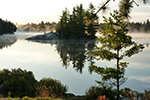
The split geography of marsh and mountains makes for great photos on this lake!
Between H8 and H16 there is a beaver dam crossing. Watch footing here as it can be very wet on the trail leading next to the dam.
H17 & H18 ‚Äď has steep water access, keep this in mind after night fall.
H20 ‚Äď is located on a small pond off of Threenarrows Lake.
THREENARROWS LAKE TO BODINA LAKE
Bodina Lake is situated across from site H20 on Threenarrows Lake. The trail to reach this lake can get very wet after rainfall and can sometimes be overgrown, watch for trail markers!
BODINA LAKE ‚Äď H59
Located across from H20 along the north-west corner of the Threenarrows section of the trail, Bodina Lake has a pretty wild feel to it. It is situated a ways off the trail and west of the lake is fairly empty country. While the bugs are more plentiful than the ridge sites, this lake is reported to be a good spot to view wildlife.
The campsite on this lake is located on a gentle slope up from the water’s edge. The site itself is quite large and flat; the swimming in Bodina however isn’t ideal, being quite weedy.
BODINA LAKE TO MOOSE PASS
Between Bodina Lake and H21 there is a small cascading falls, in the heat of the summer this is a great spot for a quick cool off! If continuing on past H21 today there is a much larger water fall before reaching Moose Pass.
The side trail to campsite H21 can be found along this next section of the trail. This site is located on a peninsula with excellent views of Threenarrows Lake.
Along this section of the trail, there is almost a 30m descent. Eventually, the path will lead to a water fall with no route around! So to continue, climb the face carefully! Pay extra attention during, or soon after rainfall.
The ascent to Moose Pass is demanding and special attention should be paid to footing. Impressive views southward are not to be missed.
MOOSE PASS
Moose pass is one of the most difficult sections of the La Cloche Silhouette trail. There is a small stream that flows from a couple of smaller lakes to the north and if water levels are down there may not be any water in the stream at H23. Heading east from the stream in Moose Pass will lead to a higher elevation with a stunning lookout.
H22
This site is on an unnamed pond on the northern ridge. While not as nice as some of its larger, deeper brethren, it is a good spot to spend the night. The trail does go right past the campsite, but traffic isn’t too heavy on this remote stretch of the circuit. This site has good potential for off trail exploration. The Moose Pass area and Moose Lake are neat to explore. Be equipped if attempting this, bring along sufficient amounts of water, a map, compass and a buddy!
H23
This site isn’t recommended if swimming is in mind, as it is located in the forest on a creek rather than a lake. Site-wise it is probably the least desirable site on the northern section. However, it is a great place to do a little off trail exploration. Moose Lake and the ridges around are quite interesting. Be equipped if attempting this, and make sure food is secured back at the site.
MOOSE PASS TO SHIGAUG LAKE
The climb from Moose Pass stream, through an old growth hemlock stand is steep and the footing can be slippery. The climb is well worth it, as the hiker is rewarded with changing vistas of the surrounding countryside from the ridge tops.
This section of the trail can be quite strenuous but very rewarding, the magic of the forest and the views from the higher peaks enlightens the inner senses!
SHIGAUG LAKE ‚Äď H31, H32
The trail up to Shigaug Lake runs along a creek and passes a few low volume waterfalls along the way. Expect to see some giant hemlock, silver birch and white pine trees in this area.
This is a beautiful lake with a really wild feel! Come night fall, don’t be surprised to hear the howls of wolves in the area. Of the two sites, H32 on the far side of the lake is preferred.
West of the lake is a high ridge for those with energy to spare and wanting a place to wander. Remember, bring along a map and compass while doing any off trail hiking.
SHIGAUG LAKE TO LITTLE MOUNTAIN LAKE
Although this is a short distance there is a bit of a climb then a steep decent before reaching Little Mountain Lake. The trail descent to Little Mountain (clockwise travel along the Silhouette trail) is probably the most intimidating, exposed part of the trail - heading down shear white quartzite. Pay attention to footing here, especially after rainfall.
LITTLE MOUNTAIN LAKE ‚Äď H33
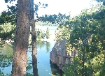
Little Mountain Lake is simply stunning! The walls are steep, the water is clear and is often compared to the Caribbean!
Little Mountain Lake is also along a canoe route connecting Great Mountain Lake and Kirk Creek, so there may be the bit of paddling traffic.
LITTLE MOUNTAIN LAKE TO DAVID LAKE AND BOUNDARY LAKE
After Little Mountain Lake it is approximately 5.2 km to the intersection of the hiking sites of David and Boundary Lake! Both lakes are a little ways off the trail and we only suggest checking them out if choosing not to hike Silver Peak today. There is quite a bit of elevation to tackle in this section however spectacular views of Kirk Creek can be seen!
DAVID LAKE ‚Äď H34
Situated at the base of Silver Peak, David Lake is one of Killarney Provincial Park’s more popular destinations. David Lake’s rugged beauty is framed by the rolling foothill crag at the base of Silver Peak as well as other spectacular rock formations. Amateur botanists may be surprised to find that the lush forest surrounding David plays host to a rare mix of fir, maple, poplar, and oak trees. These tree varieties almost never grow together, and it is only around David Lake where geographic conditions allow such a combination. Oak trees rarely grow this far north or at such high elevations, however they can be found in abundance throughout KPP.
While hiking the La Cloche Silhouette trail there is the choice between David and Boundary, David being the less desirable choice due to the view which looks out over the flatlands rather than at Silver Peak as Boundary does. Nonetheless, it is a nice site. David is a large lake, and it has a high loon population. This means there’s a good chance of nature’s finest choir in the evening.
BOUNDARY LAKE ‚Äď H35
Boundary is a small quiet lake located just off the hustle and bustle of David. Boundary Lake is separated from Kirk Creek by this peninsula making it very secluded and away from the paddling site on the lake.
Boundary Lake is a beautiful site looking straight out at Silver Peak. As most people do the trail clockwise, it gives some good anticipation for the trip to the summit the following day. Given the choice between David Lake and Boundary Lake, most people prefer the Boundary site.
DAVID LAKE AND BOUNDARY LAKE TO SILVER PEAK
Return to the main trail from the campsite and continue along the trail over wide open fields of exposed quartzite towards Silver Peak!
SILVER PEAK
Climb to the highest point in Killarney Park!
Pack a lunch and enjoy spectacular views of the park and Georgian Bay from the highest point in Killarney Provincial Park.
Sturdy footwear is recommended because certain sections of the trail can be very steep. Many hikers like to leave their large pack tucked away and bring along a small day pack with water, clothing and snacks. The elevation is not extreme but conditions can vary considerably from the lakeshore to the exposed ridge tops.
The La Cloche Mountain range is approximately 2.3 billion years old and at one time its peaks were taller than the Rocky Mountains. Years of erosion from wind, water and frosts have caused these once massive cliffs to transform into rolling hills. The white quartzite is one of the most recognizable features of KPP and amazes geologists and tourists alike.
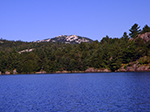
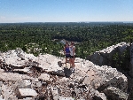
The exposed quartzite peak is rewarding with a spectacular 360-degree view of KPP and the vast waters of Georgian Bay. At one time, Silver Peak was destined to be a ski resort that would compete with Mount Tremblant. However, due to its steepness and isolation the project was cancelled and Silver Peak’s natural beauty was protected. Despite the lack of ski facilities, Silver Peak’s mixture of pink granite and white quartzite still draws tourists to its base. Sitting at an elevation of 543m (nearly the height of the CN Tower in Toronto) this hike is surely an unforgettable adventure that will make you feel on top of the world
Click Here To See Our Day Hike option for Silver Peak
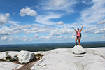
Yay! I made it! |
|---|
SILVER PEAK TO SILVER LAKE
Upon reaching the bottom of Silver Peak, grab your large pack and head east bound along the Silhouette trail towards Silver Lake! Keep a map at hand during this section as it intersects with the remainder of the day hike trail to Silver Peak accessing from Bell Lake and a portage.
This section gives a nice balance between hemlock and birch forested area and elevated rock lookouts.
SILVER LAKE ‚Äď H37, H38
Silver Lake is another stunningly clear lake! Nestled up in the ridge east of Silver Peak, Silver Lake is close to the trail that links the La Cloche Trail to Bell Lake for day trips to the summit. During the high season there is a lot of day trip traffic to Silver Peak, although traffic dies off considerably in the shoulder season.
H38 ‚Äď has steep water access
There is an amazing view from the quartzite ridge on the east side of Silver Lake. Look down over the lakes crystal clear waters with Silver Peak looming in the background. There is no trail here ‚Äď only go if equipped with a map, compass and a buddy.
SILVER LAKE TO BUNNYRABBIT LAKE
This next section of the trail remains mainly on top of Killarney Ridge, although a few inclines and declines are along route but should pose no difficulty. There are stunning lookouts while on route to Bunnyrabbit Lake which over look sections of the park with views of Blue Ridge in the background.
BUNNYRABBIT LAKE ‚Äď H45, H46
Bunnyrabbit Lake viewed from the air (or on a map) looks exactly like a rabbit. It is also one of the nicest lakes on the trail. Steep quartzite walls and clear water, typical of the ridge lakes makes for an excellent swimming spot!
H46 ‚Äď has steep water access
For those with energy to spare, there are some lakes just north of the trail to explore in this region such as the clearest lake in the park Whiskeyjack Lake having similar waters to the ultra clear Nellie Lake. Be equipped if going off trail, take along a map and compass.
BUNNYRABBIT LAKE TO HEAVEN LAKE
Shortly after the trail is rejoined from Bunnyrabbit, keep the map handy there is an area that appears to go both straight and to the left. If the straightaway is chosen, it will lead to the edge of a cliff! The trail at this point becomes increasingly rocky and hilly.
‚ÄėTRAIL‚Äô TO WHISKEY JACK - Bushwhacking
Along the route between Bunnyrabbit Lake and Heaven Lake, stray off course to access this marvel. As always we recommend having a map, compass, good shoes, and a buddy when venturing like this. Have a look at a map to determine the easiest route according to elevation. Try using the trail to Hemlock Lake and use the stream that links the two lakes to create reference points.
WHISKEYJACK LAKE
Whiskeyjack Lake is the clearest lake in the Killarney Provincial Park. This lake is clearer than Nellie Lake in the northern section of the park; however Nellie can be accessed by canoe routes. From this lake there are excellent views of the rising hills of Blue Ridge and Silver Peak.
HEAVEN LAKE ‚Äď H47
Heaven Lake is a favorite of many hikers! While quite nice, Heaven doesn’t get the name from its beauty; it gets that name from its location. This is one of the highest elevation lakes in the park, and it is situated on the edge of the ridge. Walk from the water’s edge to see a view of Georgian Bay!
There are some beautiful lakes off the trail in the Heaven Lake region. If time permits, and proper precautions are taken (map & compass), go exploring after setting up camp.
HEAVEN LAKE TO PROULX LAKE AND LITTLE SUPERIOR LAKE
Shortly after Heaven Lake, the trail meets with the Kakakise Lake to Norway Lake portage, take the portage northbound towards Norway to ensure the correct direction. Watch signage here as you will be hiking a section of the portage. Keep a map at hand to ensure where the trail meets with the portage.
The trail leads through the forest and up a couple of steep sections before passing alongside Shingwak Lake.
Proulx Lake and Little Superior Lake share the same campsite trail, Little Superior can be found first located on the left hand side of the trail and Proulx Lake can be found by continuing on the same path.
PROULX LAKE ‚Äď H48
Proulx Lake, with its great site on a peninsula, is gorgeous. Cliffs with crumbling boulders below and clear water make for some stellar views. The campsite has steep water access, keep this in mind at nightfall.
Proulx, and its neighbor Little Superior, are the last of the lakes at high elevation before arriving at the marsh lands of the final lakes leading to George Lake campground.
LITTLE SUPERIOR LAKE ‚Äď H49
Little Superior, like Bunnyrabbit, is named after its shape seen from the air; its resemblance to Lake Superior is uncanny. The lake itself is amazing, and Blue Ridge can be seen in the distance from some points on the lake.
This lake is beautiful, secluded, and a great place to spot wildlife! The only campsite on the lake has large tent pads and rocky outcroppings of quartz that make excellent jumping rocks into its clear blue waters.
PROULX LAKE AND LITTLE SUPERIOR LAKE TO THE CRACK
The trail from this section leads along the stunning white quartzite ridge tops of the Killarney Ridge. This section has a lot of sharp quartzite rocks pay attention to footing along this section.
THE CRACK
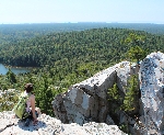
The view from The Crack provides the hiker with a panoramic view of interior lakes, quartzite ridges and to the open waters of Georgian Bay. Below lies Killarney Lake and just to the west O.S.A. Lake.
O.S.A. Lake is dedicated to the Ontario Society of Artists in recognition of their efforts to save the area from being logged. In 1932, Group of Seven Member A.Y. Jackson fought successfully for the creation of a nature preserve here.
Click Here To See Our Day Hike option for The Crack Trail
THE CRACK TO SEALEY’S LAKE
The Silhouette trail remains relatively flat for an approximate 500m and then starts to decline, gradually at first, then quite sharply down to ‚ÄúThe Crack‚ÄĚ, a deep crevasse that forms walls on the sides of the trail. Climbing down "the Crack" requires concentration and effort, watch footing carefully‚Ķespecially with a heavy pack. Large boulders broken away from the rock faces provide the "stairs" which must be negotiated to reach the bottom.
Follow along the day hike trail for another kilometer until reaching Kakakise Lake, here there is an intersecting portage from Killarney Lake on your right; continue past here along the trail.
Kakakise marks the meeting point of two geological plates, with granite to the south and quartzite lying to the north. The trail then starts to run through the forested area alongside Kakakise Creek. The scenery changes from deep hemlock woodlands, to rocky heights & towering pines, through lush deciduous woodlands and into the heart of the fens. The next intersection along the trail is where the La Cloche Silhouette trail splits from the day hike trail…keep right! Signage here will direct you to the George Lake Campground.
Continue through this low lying forest area to locate Sealey’s Lake. Once this marsh land has been reached pay close attention to footing as some muddy areas along the trail might try and suck in your boot!
SEALEY’S LAKE - H50
Sealey’s Lake is located in the marshy bog lands of the park. It does have beautiful surroundings, and the frogs can put on quite a concert during spring evenings. It is also prone to large numbers of mosquitos. Overall, this is nice camping, but swimming is not ideal.
SEALEY’S LAKE TO WAGON ROAD LAKE
This section of the trail is mainly flat and leads along Freeland Lake in some areas!
FREELAND LAKE
Freeland is a shallow lake, and during the summer can be full of aquatic plants such as pickerel weed and water lilies. Be on the lookout for the moose, beaver, muskrat, and herons who feed on these plants. This is a great place to see some wildlife - if quiet!
WAGON ROAD LAKE ‚Äď H51, H52
As with Sealey’s Lake, Wagon Road Lake is located in the marshy bog lands of the park. It does have quite stunning surroundings however. It is also prone to large numbers of mosquitos. Overall, this is nice camping with two sites on the lake, but swimming is not ideal.
WAGON ROAD LAKE TO LITTLE SHEGUIANDAH LAKE
There is not far to go before reaching Little Sheguiandah Lake! The trail is relatively flat until reaching the lake where there is an impressive lookout over the lake with views of George Lake in the background!
LITTLE SHEGUIANDAH LAKE
Little Sheguiandah has a high lookout on the pink granite ridges plunging into the lake. Paddlers may find their way to this lake when tripping George Lake as only a sliver of sloping land separates the two lakes. Campsite H53 is located lower on the southern shores after descending from the lookout point.
LITTLE SHEGUAINDAH LAKE TO A.Y JACKSON LAKE VIA CRANBERRY BOG
On the very last leg of the La Cloche Silhouette Trail it is met with another day hike, Cranberry Bog. Keep a map at hand and make sure to follow the blue trail markers!
CRANBERRY BOG
The Cranberry Bog Trail offers a fascinating look at the park's dry and wetlands. Cranberry Bog leads hikers past some of the park’s loveliest scenery. Bogs, marshes and swamps grow a variety of plants such as sundew, leather leaf, pitcher plan, and cranberry. Beaver feed piles can be seen along the way. Many birds frequent this trail’s habitats, and Blanding’s Turtles have been known to make occasional appearances in Cranberry Bog.
From a geological perspective one is able to observe the glaciation ranges from smooth rock surfaces, to glacial striations and, chatter marks
Continue on the trail following the blue trail markers; unless a detour onto the trail is desired! Again, the day hikes are marked in red not blue.
A.Y. JACKSON LAKE
A.Y Jackson, named after the Group of Seven painter that frequently visited the area for inspiration, is very pretty and conveniently located. This lake looms over George Lake on its northern shores and empties into George by a small stream. It can also get some foot traffic during the day due to its proximity to the campground and being located along the Cranberry Bog Trail.
A.Y JACKSON LAKE TO GEORGE LAKE CAMPGROUND
The last kilometer is quite rocky with a short steep descent to George Lake. This marks the end of your journey!
If the vehicle was parked at the end of the trail on the first day, jump in and head out. Otherwise it is suggested to leave the packs here and hike through the campground to retrieve the vehicle and return to pick up the packs.
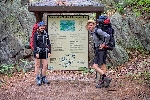
Hard work pays off! |
|---|
Although: If you have ever trekked the La Cloche Silhouette Trail, you won’t believe this accomplishment!
La Cloche Silhouette Trail - Record - 9hrs 25mins 45sec.
EXTREME HIKING (mountain trail running) Eric Batty La Cloche Silhouette Trail, Killarney Ontario
http://ericbatty.blogspot.ca/2010/10/la-cloche-silhouette-trail-visual.html
WILDERNESS TRAILS - 10 Days on the La Cloche Silhouette Trail
Wilderness Trails shares with you the experience of
hiking through the backcountry of Killarney Provincial Park.
